
Surprising Ways You Can Reduce Costs Through Surveying
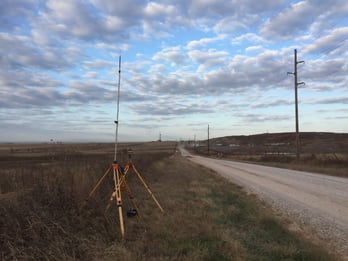
As things move faster and faster in all aspects of the oil patch, many producers and midstream companies feel pressured to get site surveys done as quickly as possible—maybe too quickly. It appears at first glance that this would be the fastest way to get construction started on a well pad or pipeline. In our experience, the exact opposite is true. Moving so quickly that you don’t have some basic data in hand when you talk to the land surveying company can cost you dearly in both time and money. Incomplete data can result in redoing a survey, moving a location or rerouting a pipeline and a variety of other unbudgeted costs.
 The purpose of a survey, for E&P companies, is to generate a plat, or series of plats, to be used for permitting or drilling and for staking a well location. The end user is the construction company, who bases their work on the plat design. With laterals now extending for multiple miles in all directions, the plat can also show which nearby landowners will be affected by the drilling and production process. Proper payment of oil and gas royalties depends on this part of the land survey. A proper survey also reduces the likelihood of litigation.
For midstream companies, the survey’s purpose is to create a plat, alignment sheets and other deliverables to be used for constructing the pipeline and any attendant pumping or compressor stations and connections along the way.
When starting to work with a survey company, here is an example of how a well-intentioned midstream company wanted to take a time-saving shortcut that actually ended up creating delays. This client was very anxious to start their project quickly because they had a very short window in which to complete the pipeline project. The challenge was that they were not clear on what would happen at the end of the pipeline. At the time, they did not know where or how it would tie into the rest of the system. So we completed the land survey, plats and alignment sheets based on our best estimates of how the connection would work. By that time, they had decided how it would actually work, which was different from our estimation. Armed with this new data, we redid the survey.
Because our land survey team did not have a well-defined scope going into this project, it ended up costing the client more money in the form of change orders. When this project went to construction, that team struggled with an undefined scope. That coupled with a short fuse on the project resulted in delays and unexpected change-orders. The delay in the start and completion of the project certainly had indirect costs that our customer had to incur as well.
Incomplete information is still not enough
 Some clients are proactive and work to give us information such as Google Earth or equivalent satellite cartography; however, there are a couple of reasons that other options provide more of the details needed to complete the land survey.
- First, these maps are not updated very often. According to Google Earth Blogs, maps are typically updated every one to three years. We have received maps like this, only to go to the site and find the desired location populated by new buildings, repositioned fences—and the occasional wind turbine—or other uncharted surprises.
- Second, Google maps never show the terrain. Important features like hills, creek beds, flood plains and more need to be pinpointed before the survey starts. For a drill pad, the need is obvious—It is more expensive to put the drilling rig on the side of a hill, and you can’t put a tank battery in a creek bed.
And for pipelines, anywhere we have to put a 90 degree turn or run a pipe uphill, it affects the pressures in the pipe, whether it’s transporting liquid or gas. When planning for a compressor station or other above ground facilities, it is critical to ensure the most recent mapping data is provided for planning purposes. Nothing replaces a site recon by the client prior to releasing it for land survey, but understandably this can’t always be completed due to time constraints or budgets. One solution would be a site recon completed early in the process with drone imagery provided to the customer for planning purposes. This imagery can be overlaid with their final deliverables instead of using the outdated imagery discussed previously.
It is important to note that a pipeline project is not finished until the right of way is restored, all fabrication is bolted up and the hydrotest and dewatering are complete. If a client doesn’t have a clear plan and scope from the beginning, that last bolt is only tightened after one or more reworks and sometimes extensive amounts of change orders leading to extra costs. We have seen clients have to rework a plan as many as five times before they got us the final information needed to complete a project.
The most important takeaway here is that uncertainty is expensive—for two reasons.
- There are the aforementioned changes and reworks with their attendant cost overruns.
- Second, when we know the data is incomplete, we have to charge more to accommodate contingencies such as the need to replat as new information arrives. We may be the first ones on the site, which will require more investigation time. From a construction perspective, the more unknowns there are in your scope, the more expensive the construction bids will be for your project.
The cost of a survey is minuscule compared to the millions of dollars spent on the overall project. Trying to save money by hurrying or taking shortcuts with the land survey rarely works, and can eventually cost many times the expected savings. This is true for clients in both of our main business segments—producers who are preparing a drilling site or running a short length of pipe from a well to a collection point, or midstream companies looking to install miles of pipe.

"How clients can save time and money"
Surprisingly, the fastest and most efficient way to get a land surveying job done is to slow down. Spend some extra time at the beginning gathering important information in order to minimize costly surprises later. Here’s what that looks like.
- Talk to your survey company. We will be glad to consult with clients from the start. We need to know the general layout of the site—locations of tanks, where the hole will be, access points such as roads and gates and more. Midstream surveys are more complex due to their greater distances. It is not unusual for a pipeline to cross the property of 20 or more landowners and to encounter more changes in terrain, so communication and planning are critical on these projects to keep costs down as well.
- Investigate. On the E&P side, it is a good idea to send someone to the site before talking to us, in order to identify any obstacles. If there is a building right where the tanks need to be, we may need to adjust the location. In more than one case, we’ve had to move the site across a road due to obstacles at the original site. If it’s not possible to visit the prospective location, we can utilize new technologies such as drones to get up to date aerial imagery. Midstream companies often rely on a right-of-way firm for some of this information, but there is still no substitute for sending your own personnel to survey the site. The more you know about the route from the beginning, the clearer picture we will have when we start—so we can give an accurate bid that ultimately keeps your land survey costs lower. More importantly, it keeps your project from having costly change orders and higher bids during construction.
- Be aware of the surroundings. Are there powerlines overhead? Are there existing pipelines underground? Is there a subdivision nearby that could require special accommodations? Does the landowner have any special requirements? No site is an island, and it’s always a good idea to look at the bigger picture before starting the survey. On midstream projects or well sites in congested areas, subsurface utility engineering, or SUE, can be extremely helpful in identifying subsurface utilities to assist with planning.
- Plan the start and the finish. If there is a pipeline extending out from the site, where will it terminate on the other end? How will it connect? Do you need right of way or other considerations? The more preplanning put into your project the lower your overall costs will be. Having a thorough land survey completed with high quality deliverables will also reduce the amount of unknowns in your scope, in turn lowering your overall construction costs.
Summary:
You might say that what we really need would be the keys to the castle. If a client lets us partner with them in that way—giving us all the data we need—we can make sure the outcome meets our client’s expectations, reduces last minute changes and ultimately lowers their overall project costs. This allows us to fully do our jobs and exceed our client’s expectations, which streamlines the production or midstream process, letting everyone concentrate on what they do best. Client, right-of-way, survey and construction: when all these companies work as a team, it is amazing how smoothly—and cost-effectively—a project can be.
The flip side of “uncertainty is costly” might be “planning is power.”
For more information on how our survey company can help save you time and money, contact Gary Paule at gpaule@gatewayok.com.
